
The walk from the middle of the village to the cablecar is just over a mile and we joined other walkers who were making the trip. This particular cablecar can carry up to 45 passengers, though I have to say it is a bit cramped and stuffy when filled to capacity!

The cablecar soon whisks you up high above the village. This shot is looking down the first span back to the village, a span of 250 metres (over 800 feet!).

Looking to the west from the cablecar, down into the Gasterntaal Valley.

Another view into the Gasterntaal with the Doldernhorn on the left and the Untertatelishorn on the right.

After about ten minutes, the gondola arrives safely at Sunbuel. You will have been subject to the most spectacular views on all sides.

Stepping out of the cablecar station you realise that you have arrived in what can only be described as a mountain paradise.

The air is so clear, the light so strong and the colours so fresh. Sunbuel is situated at 1938 metres, or around 6,300 feet.

The initial part of the walk is downhill towards Spittelmatte, a summer pasture. We have been here on mid summer's day with a fresh, four inch layer of snow, but most times it has been as spectacular as this.

Spittelmatte, with the summer farm on the right and the Rinderhorn on the left.

This is the point where the Canton Bernese Oberland ends and the Canton Valais begins.

It is also the point where an avalanche claimed the lives of six men and 169 cattle. on September 11th 1895 a 4.5 million cubic metres of ice broke free from the Altels Glacier and covered an area of approximately two square kilometers, destroying all in it's path. A memorial plaque is set into the rock at the side of the path, commemorating those who perished.

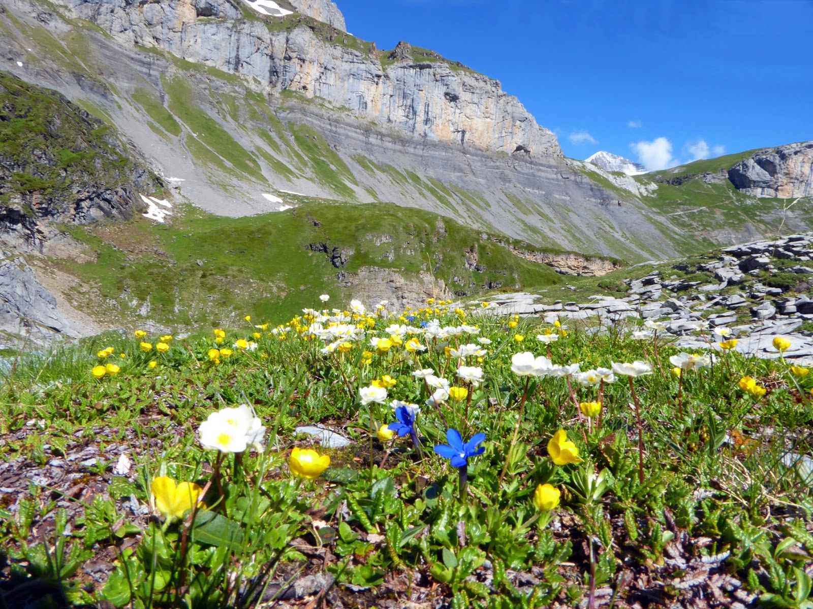
The wild alpine flowers all along this route are breath taking.

From Spittelmatte the path gains height towards Schwarenbach. This view is looking back, down over Spittelmatte.

Around this point we spotted this fox running across the path and through the boulders. A lovely sight.

As the path levels out Schwarenbach guesthouse comes into view, seen here amidst the mountain landscape near the middle of the photograph.

Schwarenbach was built as an Inn in 1742 and demolished by avalanche in February 1743. It was then rebuilt nearby in it's current position, a more sheltered location. Over the years it has given shelter to many travellers including Lenin, Mark Twain and Alexander Dumas. As for us, we like to use it as a refreshment point on our walk.

The view from Schwarenbach. At this time of year there is often a small, temporary lake of melt water just below the guesthouse. The onward path to Daubensee and Gemi Pass goes from left to right through the photograph, to the lowest point on the horizon.

As the path climbs up from Schwarenbach the wild flowers become more alpine with lots of mountain pansies.

Millions of gentians.
And natural rockeries that will leave you speechless.

After about half an hour of uphill, the path levels out and Daubensee comes into view.

Daubensee is a shallow lake of meltwater and some years, as the summer progresses it can almost dry up. Other years, we have been up here and seen mini ice bergs floating in the lake!

Wild flowers grow right up to the waterline. This one is a saxifrage.

The path rises fairly gently from Daubensee up towards Gemmi Pass.

Purple saxifrage growing in the shales near the path.

Pennycress

Purple Saxifrage


Purple saxifrage in what can only be described as a spectacular setting.

Moss campion


At this point, just below the pass, it is quite unusual for there not to be any snow, but they are short stretches and well worn by the feet of many walkers.

Snow gentians

At last, the pass and the view down to Leukerbad in the Valais and beyond to the high mountains of the Valais.

Looking down to the town of Leukerbad.

In the distance, The Matterhorn on the right and Michabel on the left, the highest mountain entirely in Switzerland.

All that's left now is to retrace our steps over the six miles back to the cablecar and if we still have enough energy when we get there take the path down. But the thought of that 3,600 foot decent and then another mile or more back to the village...... I think the cablecar sounds like a good option.
More to follow very soon.
No comments:
Post a Comment